Day Trip to Whidbey Island: Hiking at Ebey’s Landing
June 4, 2013

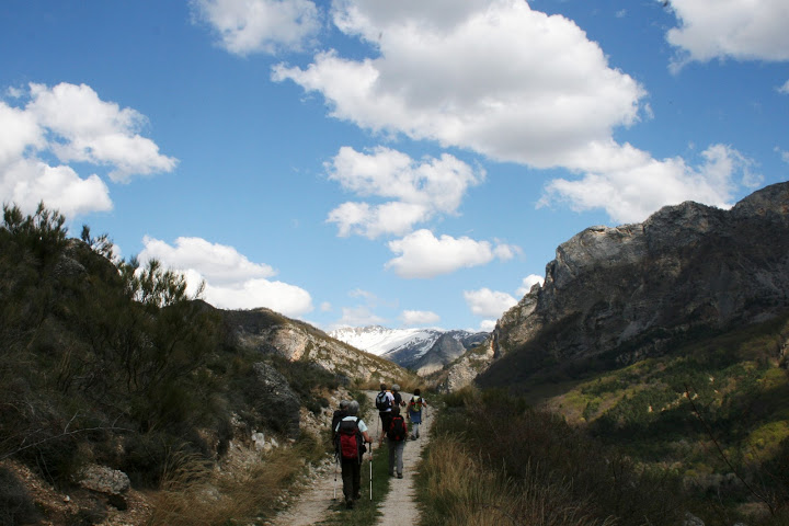
Approaching Ebey’s Landing trailhead
“I leave this notice
on my door
For each accustomed
visitor:
I am gone into the fields
To take what this sweet hour yields.”
— Percy Bysshe Shelley
I take most of my out-of-town guests to Whidbey Island for hiking at Ebey’s Landing. The journey itself is half the fun as it involves a ferry ride and a drive along country roads with old barns.

Old barn, Whidbey Island

Another old barn

Ferry viewed from the bluff at Ebey’s Landing
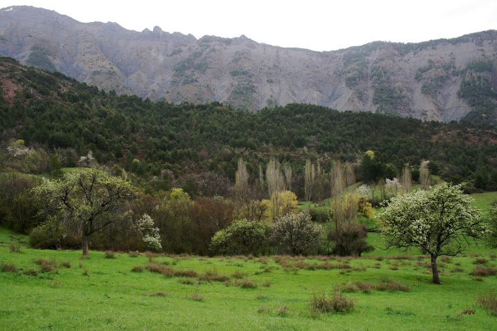
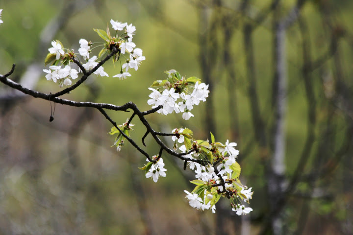
The hike itself is pretty spectacular no matter which season I take guests there. The trail is a pleasant loop, up a bluff, and then along the beach on the way back. This past weekend the landscape was as green as I’ve ever seen it.

Stairs at the start of the hike

Notice the hikers (like ants) on the bluff and on the shore

The initial uphill stretch. The path soon levels off at the top of the bluff.

View of farmland from the bluff; so green

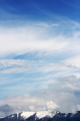
View from Ebey’s Landing

Lupine

Steep slope

Tree sculpted like bonsai

Wildflowers

Driftwood along the beach

The homeward stretch along the shore

Seaweed

Seaweed and rocks

Beach sculpture
Hiking in France 3: Goldsworthy Refuges d’Art
May 28, 2013
“There is this form I can’t stop making which is really snakelike, but I often think of it as a river. It’s the idea of fluidity that is the connection, but I’m not really talking about a river either. It’s the movement that interests me.”
— Andy Goldsworthy, Wall
Andy Goldsworthy clay wall sculpture in the Vieil Esclangon Art Refuge
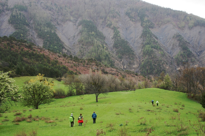
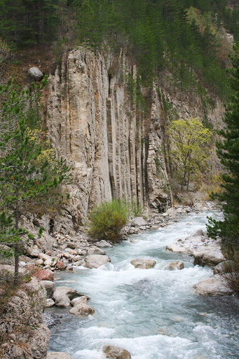
On Days 3, 4 and 5 of our hike, we saw five Goldsworthy works installed in Refuges d’Art, small buildings or shelters, where individuals are allowed to camp overnight. Our hiking trails took us up and down mountains, across rivers and creeks, with some of the most spectacular scenery of my trip.
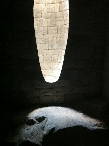
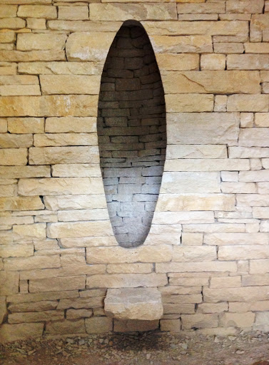
We returned to the wild valley of Vancon and hiked to the Church in the abandoned hamlet of Forest. The ruins of the church were restored to house a Goldsworthy wall sculpture, another recessed elliptical space. In contrast to the one at the Chapelle Saint Madeleine, this one was a light hole in a dark wall.

Goldsworthy installation in the Church of Forest

Old crucifix over a grave outside the church
Goldsworthy wall sculpture

Lunch break and nap in the hamlet of Forest

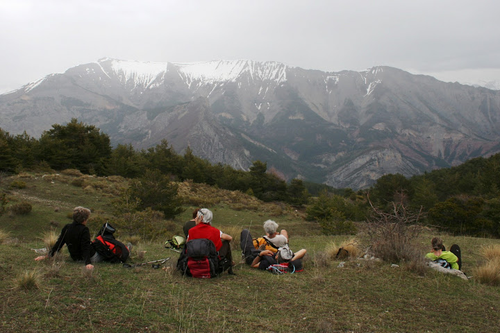
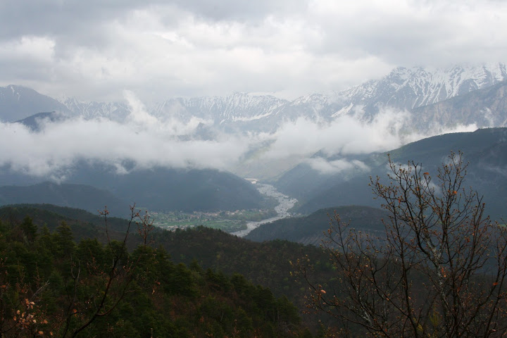
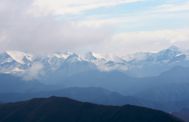
We hiked high in the mountains along an old “tax trail” to the abandoned village of Faissal. We seemed to climb ever higher, with grand views of the distant Alps and curious mountain goats watching us from the summit of an adjacent mountain. And then down, down again.
“Hill and valley followed valley and hill.” — Robert Louis Stevenson, from Travels with a Donkey in the Cevennes
Hiking is much too absorbing to allow much thinking, I’ve found. I moved through the day, step by step, always alert to where I was planting my feet. I didn’t want to slip on a loose rock and fall or hurt myself. I was very much in the moment, a satisfying feeling.


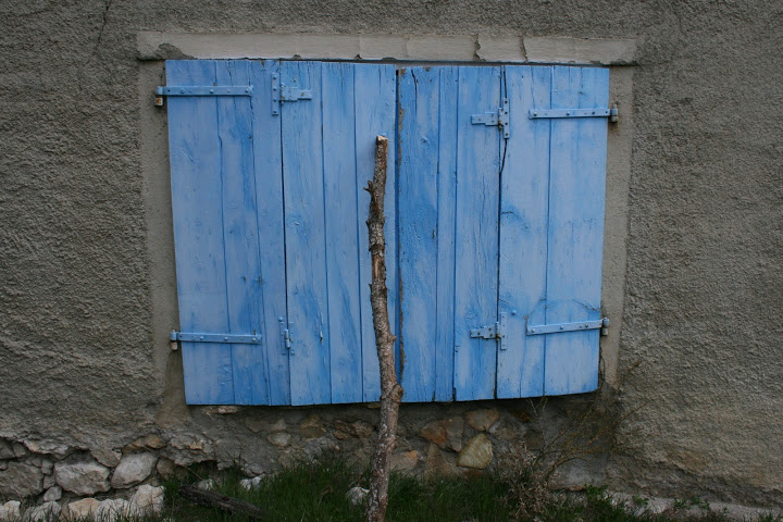
Blue doors on ruin, the village of Faissal

The refuge at Vieil Esclangon

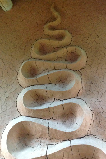
Goldsworthy river-like clay sculpture

Goldsworthy sculpture with x-ray effect


The Refuge of Eschuichiere featured two rooms with wall art fashioned by Goldsworthy of rock with natural lines of contrasting color.
“Stretching out lines that already exist interests me more than imagining new ones. I have made lines that explore and follow the contours of a rock, the edge of a river, the growth of a branch, the junction between house and street . . . The intention is not just to make a line, but to draw the change, movement, growth and decay that flow through a place.”
— Andy Goldsworthy, Wall


At the end of Day 5, our guide Eric drove us in the van to the farm Belon, which was formerly owned by one of the leaders of the French Resistance in WWII. In the basement we found several of Goldsworthy’s stone arches. One of our hikers, Michele, mused about the significance of this “underground” space and its resonance with the “underground” resistance movement.


I found the entire five-day hiking experience very rewarding. Not only did I get to see some Goldsworthy art that I would never have been able to find on my own, I also enjoyed the company of some French natives on their home turf. It made me realize how difficult it is for me when travelling to spend ordinary time with local people. Typically I am staying in hotels, eating in restaurants, and going to tourist sites — with a bunch of other tourists. With this guided hike, I had the unusual (for me) opportunity to keep company with some interesting French people, share home-cooked meals at farm tables with them, and even sleep in shared rooms in auberges and gites. I found that they are great conversationalists (even though I could not understand or speak French, they made an effort to speak English from time to time, and I watched their lively conversations with interest), they were enthusiastic eaters and enjoyed leisurely meals together, they were well read, and they liked President Obama!
Hiking in France 2: Andy Goldsworthy Sentinels
May 27, 2013

Andy Goldsworthy sentinel near Authon
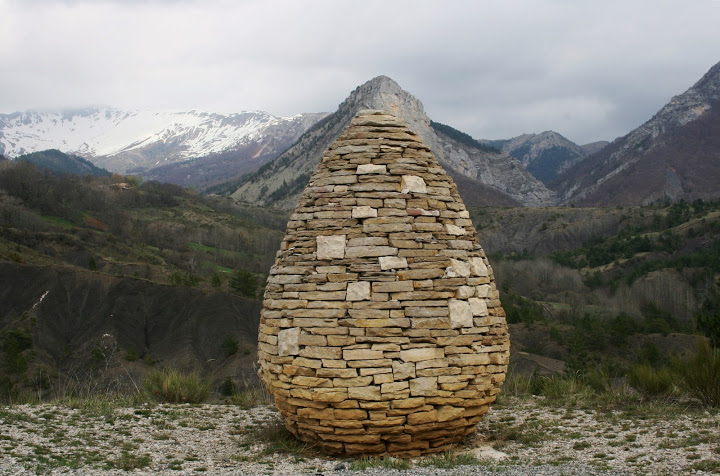
Andy Goldsworthy built three sentinels in this part of France, and we hiked to two of them — the Authon sentinel on Day 2 and the sentinel in the valley of Bes on Day 4. All are accessible by road, but Jean-Pierre felt that hiking to them would give us a better feel for the land elements that inspired Goldsworthy. The sentinels stand like guardians in the landscape. Although there is no mortar in the stacked stones, they are solidly built — sturdy and steadfast.
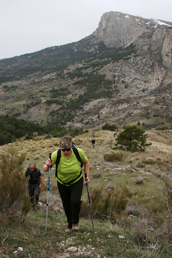
Day 2 was perhaps the most challenging day of hiking for me. We were on the trail from 9:00 a.m. to 5:30 p.m. Jean-Pierre had to make last-minute changes to our planned itinerary. We were to have sheltered for the night in one of the Refuges d’Art (huts that housed a Goldsworthy sculpture), but the mountain road was too muddy, and it was impossible to get a vehicle up there with our heavy bags and camping supplies. The adapted itinerary kept us hiking, sometimes off trail, and through more difficult terrain, for a longer-than-normal day. At times I felt like a mountain goat! My worst moment was slipping on a rock and stepping one foot into slimy, smelly swamp sludge. There was also a scary traverse across scree, short, but Jean-Pierre escorted us safely across one by one. I had a terrific workout, and the reward for the day’s efforts was seeing the first of Andy Goldsworthy’s sentinels.

Terrain Day 2

The Vancon Valley

I found this shell fossil in a rock along the trail. This part of France has many fossil sites.
Cherry blossoms near our lunchtime picnic spot

Guide, Jean-Pierre

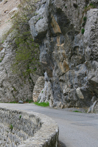
First glimpse of the sentinel near Authon

This sentinel is situated in an open space at a curve in the road.
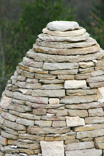
The shape of the sentinel mimics a distant mountain peak.


That’s me with the sentinel!

Sunset at the sentinel
On Day 4, after another day of hiking, we saw a second Goldsworthy sentinel in the valley of Bes. This one was situated in a natural alcove in the looming rock. It felt like a tiny beacon in a dominating landscape, and yet it felt protected, sheltered and cocooned.
First glimpse of the second sentinel
The valley of Bes

Goldsworthy’s sentinel, valley of Bes

Again, the top of the sentinel echoed the shape of a distant peak.
Hiking in France 1: On the Trail of Andy Goldsworthy
May 26, 2013
View from the trail near Courbons

Signpost along the trail; we hiked from Courbons to Thoad on Day 1
I signed up for this guided hike for the chance to see Andy Goldsworthy’s sculptures, but I was blown away by the spectacular scenery. On Day 1, we hiked from the village of Courbons to Thoard. Our destination was the tiny Chapelle Saint Madeleine, perched near the summit of a hill/mountain, which featured a wall sculpture by Goldsworthy.
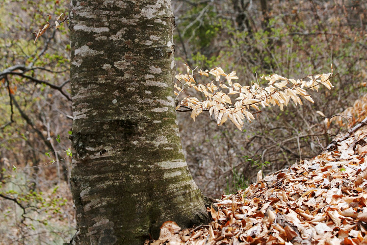
The marked trail took us up over the hilltops and gave us awesome views of the surrounding snow-capped mountains. It continued through a forest of beech trees; the fallen beech leaves provided a soft, but slippery, cushion of padding on the path. I was challenged to keep up with the group, all experienced and hearty hikers, but I was exhilarated at the same time to be in France, on this hike — a dream coming true.

View at the start of the hike, up from the village of Courbons
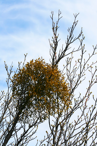
Mistletoe along the trail — it was a common sight

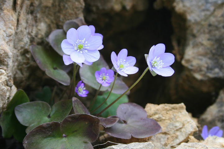
Wildflower (windflower?)


Trail through a beech forest


Near the end of the day’s hike, we approached the tiny Chapelle Saint Madeleine via a gravel road that passed lavender fields. The chapel, like many of the buildings in this area, had a tile roof of the most pleasing orangy colors. The tiles were held down with stones. Inside, on the wall where the altar would have been, was a recessed elliptical-shaped space large enough to stand in. Goldsworthy intended this as an introspective space, a contrast to the vast expanse of the vista looking down into the valley just outside the door.

The road to Chapelle Saint Madeleine near Thoard
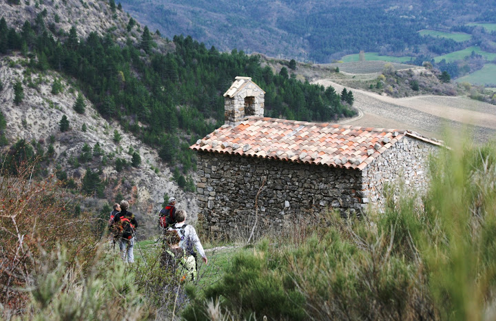
Our destination for Day 1, Andy Goldsworthy’s wall art in this chapel
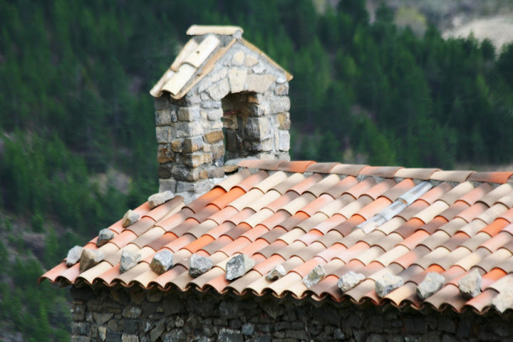
Tile roof, exquisite colors

Andy Goldsworthy wall sculpture, Chapelle Saint Madeleine

View down the valley from the Chapelle Saint Madeleine

The day’s final steps, walking to the cottage Bannette, our farmhouse lodging for the night
Iceland Impressions 2
May 7, 2013
“We do not take a trip, a trip takes us.”
— John Steinbeck, from Travels with Charley

Paved path following the coastline near Keflavik
One of my favorite things to do on my travels is to simply walk or drive around, see what presents itself, and take photos. So on my stopover in Iceland, I donned walking shoes and set out from my lodging at the Hotel Keflavik and followed the paved path along the coastline. I walked for about four miles before I turned around to come back, and I did not even reach the end of the path. I felt like a solitary walker, so few people did I meet en route.
I fell in love with the tidy, modest-sized houses, with their red and blue roofs. One yellow house was particularly cheerful. I felt that, in comparison, our huge sprawling houses in the U.S. are too often ostentatious and wasteful.

The red-roofed houses of Keflavik

Blue roofs, Keflavik

Cheerful yellow house along the Iceland coast

Two historic “summer houses” in Keflavik

Downtown Keflavik, how tidy and clean
Along the path was a restored cottage called a “Stekkjarkot.” This sod-covered dwelling was typical of those from the mid-1800s. The family who lived here would have made its living from the sea.

Stekkjarkot near Keflavik
Keflavik is a sea town, with fishing boats and working harbors. Very picturesque.

Breakwater leading into a harbor

One of Keflavik’s harbors

Weathered blue shed

Fishing boat seen from a bluff
After walking four miles in one direction, I returned to the hotel and then walked in the other direction, through the town, and up a bluff where I followed a hard path of volcanic rock along the cliffs.

Hard path on the bluff over Keflavik
Coming back down, I passed this woman basking in the spring sunshine like a seal on a rock. (Don’t we all celebrate the return on light and warmth in the Spring?)

Welcome back sun!
I ended my day by swimming with the locals at Keflavik’s public swimming pool. For one-twentieth the cost of the Blue Lagoon, I enjoyed four or five warm soaking pools/hot tubs, a lap pool, a big general swimming pool while around me families played in the kiddie pools and water park with giant slides into yet another pool. And then I splurged on a dinner of Icelandic lamb. A perfect day.

My dinner of Icelandic lamb at the restaurant in the Hotel Keflavik
Hiking Near Mount Rainier: The Naches Peak Loop Trail
September 13, 2012

Mount Rainier reflected in Tipsoo Lake near Chinook Pass on Hwy 410
I just had to take advantage of these last sunny days of summer to head to the mountains for a day hike. I love the Naches Peak Loop Trail for its stupendous views of Mount Rainier and its wildflowers as the trail meanders past several tiny sub-alpine lakes. This is an easy hike. Heading out on the trail just ahead of me was a family with a toddler in a backpack and a two-week old baby in a sling. I parked in the lot by Tipsoo Lake and headed clockwise up the trail so that I would have Mount Rainier in full view for the last part of the hike.
Here are some photos:

The sub-alpine meadows are studded with beargrass.

Tall trees with long shadows cast by the morning sun.

Lush green along melting rivulets

Beargrass and Queen Anne’s Lace with the Cascades in the background

The trail passes along several small lakes

Shards of ice and ground frost in the shady stretches of the trail

Busy bees, butterflies and birds along the trail

Tree silhouettes

Looking down on Dewey Lake from the Naches Peak Loop Trail

The Cascade Mountains with cascading blues

If you walk the trail clockwise, you’ll have this view of Mount Rainier on the latter part of the loop hike.

The trail passes yet another lake.

A weathered snag

The final stretch, heading back to Tipsoo Lake

Trail sign with Mount Rainier on the horizon
My Annual Hike at Ebey’s Landing
August 24, 2012

Hiking trail up to the bluff at Ebey’s Landing
When I have company from out-of-town, I like to take them to Ebey’s Landing, one of my favorite hikes on Whidbey Island. This loop trail provides a perfect slice of Pacific Northwest life — a ferry ride to get there, expansive views of Puget Sound and the Olympic Mountains, bucolic rural scenery, and a beach walk. It’s not too strenuous, and a breeze keeps you cool even on a hot, sunny summer day.
We experienced a special treat on this most recent hike — a plein air artist was working on a landscape in oil pastels. I always love to see artists at work.

Easel and trays of oil pastels at Ebey’s Landing

Steven R. Hill, plein air artist

An artist’s hands

Plein air art at Ebey’s Landing

View from Ebey’s Landing: a rural landscape with Mount Baker on the horizon

View out over Puget Sound

Looking down at the lagoon from the bluff at Ebey’s Landing

View of Olympic Mountains from across Puget Sound
Exploring Seattle On Foot: Long Walk # 2
July 1, 2011
“I have never found a city without its walkers’ rewards.”
— John Finley, “Traveling Afoot”

Common sight on urban walks, waiting for the walking sign
I so enjoyed my first long urban hike across the I-90 floating bridge (see yesterday’s post), that I’ve planned several more.
I set out on my second long walk, a journey of 8-1/2 miles, from my home to the Pike Place Market in downtown Seattle. I hiked 3-1/2 hours, including stops for photos and coffee and a picnic breakfast, along a route with scenic trails. Here are some highlights:

6:00 a.m. on the path at Green Lake: notice my long shadow in the early morning light

Summer morning at Green Lake

First stop: the Woodland Park Rose Garden at 50th & Fremont Ave N (unfortunately, the gates did not open until 7 a.m.)

I could still enjoy the roses viewed through my zoom lens!

Tree-lined walk down Fremont Avenue N

Waiting for the Interurban sculpture at Fremont & N 34th Streets. It's a Seattle tradition to decorate these statues.

Trees line the Ship Canal between the locks and Lake Union. My walk took me along the Ship Canal Trail.

Rowers on the Ship Canal

I crossed over the train tracks on W Dravus Street after stopping for coffee at Starbucks.

Mount Rainier seen from the Elliott Bay Trail

I took a short detour off the trail to check out the Amgen Helix Bridge.

The Amgen Helix Bridge is a pedestrian bridge to the Amgen campus.

Looking across Puget Sound to the Olympic Mountains from the Elliott Bay Trail

Totem pole along the Elliott Bay Trail

Small rose garden along the trail, with Spaceneedle in the background

Lovely yellow roses

The trail runs along the Olympic Sculpture Park.

I walked along Seattle's waterfront to the Hill Climb to the Pike Place Market.

Flower vendor at the Pike Place Market

Truck at the Pike Place Market
Thoreau Thursdays (11): Traveling Afoot
June 30, 2011
“I have learned that the swiftest traveler is he that goes afoot.”
— Henry David Thoreau, Walden

My well-worn hiking boots
Thoreau asserts that the fastest traveler is the one on foot. A seeming paradox. But when he goes on to explain, the mystery becomes clearer. In Thoreau’s day, to travel 30 miles by train cost the equivalent of a day’s labor. Thoreau could walk that distance in one day and arrive by evening. The person traveling by rail would first have to spend a day laboring to earn the fare, and then take the train the next day. Thus, the walking man arrived first and had a day full of the pleasures of the countryside.
The economics of walking as a form of travel have changed. The price of a tank of gas is still less than a day’s labor, and it transports us over distances that would take days traveling by foot. Today a better argument for slow travel might focus on the quality of the journey, the best way to travel. We might romanticize train travel over air travel, as Paul Theroux does in The Tao of Travel: “Every airplane trip is the same; every railway journey is different.” Or we might learn that the most rewarding journeys are on foot, as Gardner McKay does in Journey Without a Map: “I came to realize that I traveled best when I traveled no faster than a dog could trot.”
As I read more about walking, I began to wonder just how far I could walk in one day. I don’t even know the farthest distance I’ve ever walked in one day. I began to crave taking a long walk. A walk in the city would do:
“These are near journeys, but there are times when they do not satisfy, when one must set out on a far journey, test one’s will and endurance of body, or get away from the usual. Sometimes the long walk is the only medicine.”
— John Finley, “Traveling Afoot,” from The Pleasures of Walking, edited by Edwin Valentine Mitchell
I planned my pedestrian expedition for one of my days off work. Now that summer is here, the days are long. I had always wanted to walk across the I-90 floating bridge, so I set my goal to walk from my home in Green Lake to Luther Burbank Park on Mercer Island, a distance of about 14 miles.
I set out under cloudy skies at 7:00 a.m. and, after stopping to take photos and have a coffee and breakfast sandwich, I arrived at my destination at noon. It was a pleasurable walk but hard on my feet. I had to apologize to my poor feet for the extra 25 pounds I’m carrying. (Another good reason to lose some weight!) I could have walked more, as the day was still young, but I decided not to risk becoming more footsore. So I caught a bus home from the Mercer Island Park and Ride.
This experience of walking 14 miles gave me new appreciation for Thoreau’s energy and stamina. Maybe I can gradually work up to walking 30 miles in one day.
Here are some photos from my first long walk in the city:

7:00 a.m. I left my front door under cloudy skies.

I walked across the UW campus and saw this squirrel in a cherry tree on the Quad.

Rose garden by the fountain on the UW campus

Pale purple rose (UW Husky colors are purple and gold)

8:00 a.m. I cross the bridge over Ship Canal between Lake Union and Lake Washington.

Morning rowers on Lake Washington

Totem pole carved by Haida artist

Signpost to Arboretum Waterfront Trail

The trail skirts the parking lot at the Museum of History and Industry

The trail runs along Hwy 520 floating bridge. Floating walkways link Foster and Marsh Islands. A sign warns of water over the trail. I proceed carefully. It's very muddy on the islands.

I see a blue heron along the trail.

The heron flies off as I approach.

Here the trail is under 4 inches of water. I take my shoes off and wade across.

Wild iris flags

Reflections of the underside of the Hwy 520 floating bridge

Next I walk down through the Washington Park Arboretum.

Western Red Cedar boughs, Washington Park Arboretum

9:00 a.m. I am standing under this Golden English Oak, Washington Park Arboretum.

Maple leaves, Washington Park Arboretum

Peaceful amble through the Washington Park Arboretum

From the Arboretum, I follow Lake Washington Blvd to the shores of Lake Washington. It's now 10:00 a.m. and I am nearing Leschi Marina, with the Bellevue skyline on the opposite shore.

Willows on the shore of Lake Washington

11:00 a.m. After a break for coffee and a breakfast sandwich, I approach the I-90 floating bridge.

I-90 floating bridge over Lake Washington to Mercer Island

Signpost for I-90 Bridge Trail

Almost across, looking back toward Seattle. It's noisy on the bridge.

Luther Burbank Park, Mercer Island

Blackberry blossoms

Old vine on tree looks like a huge crawling insect, Luther Burbank Park

Earthworks, "The Source," in Luther Burbank Park

I take the bus home from the Mercer Island Park & Ride. I transfer in the bus tunnel, Pioneer Square Station.
Seattle Day Trip: Hiking at Ebey’s Landing
June 21, 2011

On the bluff at Ebey's Landing, looking back to the trailhead
Ebey’s Landing on Whidbey Island is one of my all-time favorite hiking destinations. Every step along the trail sports impressive views of Puget Sound. It’s a fairly easy 3-mile loop hike. We hike along the bluff going out and return along the beach. Here are some photos of this year’s hike, my first hike of the season:

Patchwork of farm land viewed from the bluff

Hiking along the bluff trail

Below the bluff is a lagoon, separated from Puget Sound by a thin stretch of beach.

The bluff was full of wildflowers.

Looking down the bluff into the waters of the lagoon

Descending the bluff to the beach

Lagoon and log-strewn beach along Puget Sound

The waves sounded like a train entering a station.

Seagull in flight

Rocks and seaweed

Walking back to the trailhead along the beach

